An exam-focused explanation of Uttar Pradesh's major natural hazards, including earthquakes, floods, droughts, heat waves, cold waves, fog, and the broad disaster-management structure.
Mind Map: Natural Hazards of Uttar Pradesh
Introduction
Uttar Pradesh is vulnerable to multiple natural hazards because different parts of the state face very different physical conditions. The easiest way to remember this lesson is through regional pairing:
north and north-east: stronger seismic and flood vulnerability
east: major river floods
Bundelkhand: drought and water stress
plains in general: heat waves, cold waves, and dense fog
Once that pattern is clear, the rest of the lesson becomes much easier to retain.
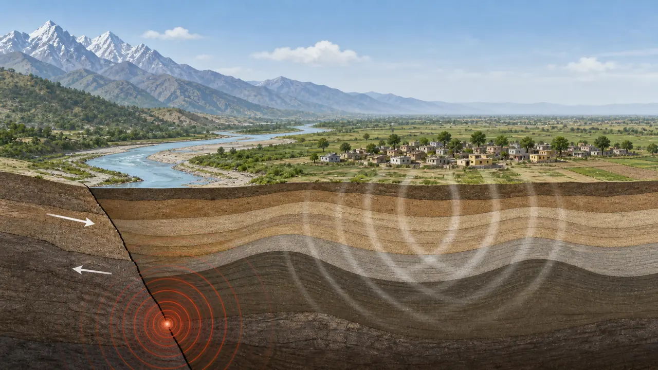
Seismic Zones of UP
India is divided into 4 seismic zones (II to V), with Zone V being the most seismically active. UP falls primarily in Zones II, III, and IV.
Zone-wise Distribution
Seismic Zone
Risk Level
Areas in UP
Zone IV
High Damage Risk
Northern UP — parts of Indo-Gangetic plain near Nepal border (Gorakhpur, Bahraich, Lakhimpur Kheri, Maharajganj)
Zone III
Moderate Damage Risk
Most of UP — Lucknow, Kanpur, Varanasi, Prayagraj, Meerut, Agra
Zone II
Low Damage Risk
Southern UP — Bundelkhand, parts of Vindhyan region
Key Earthquake Facts
Fact
Detail
Most vulnerable zone
Zone IV — northern districts along Nepal border
Reason for risk
Proximity to Main Boundary Thrust (MBT) of Himalayas
Historical earthquake
1934 Bihar-Nepal Earthquake (8.1 M) — felt severely across eastern UP
2015 Nepal Earthquake
7.8 M — significant damage in northern UP districts
Building codes
BIS (Bureau of Indian Standards) seismic design codes apply
Northern UP districts in Zone IV are at risk because they sit on deep alluvial deposits that amplify seismic waves — a phenomenon called site amplification.
Soft alluvial deposits can intensify shaking, which is why northern plains near the Himalayan belt need seismic preparedness.
The key earthquake idea is not that UP lies in the most extreme national zone, but that northern alluvial districts can still feel stronger shaking because of both Himalayan influence and site amplification.
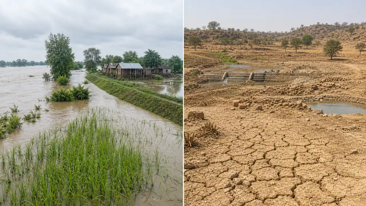
Floods — Eastern UP's Annual Challenge
Flooding is the most frequent and destructive natural hazard in Uttar Pradesh, primarily affecting the eastern and central regions.
Flood-Prone River Basins
River
Origin
Flood-Prone Districts
Ghaghra (Sarayu)
Tibet/Nepal
Bahraich, Barabanki, Ayodhya, Azamgarh
Rapti
Nepal
Gorakhpur, Deoria, Maharajganj
Gandak
Nepal
Kushinagar, Deoria
Sharda (Mahakali)
Nepal
Lakhimpur Kheri, Pilibhit
Ganga
Uttarakhand
Varanasi, Prayagraj, Ballia
Gomti
Pilibhit (UP)
Lucknow, Jaunpur
Yamuna
Uttarakhand
Agra, Mathura (occasional)
Why Eastern UP Floods Annually
Rivers originate in Nepal Himalayas — carry enormous volume during monsoon
Flat terrain with gentle gradient — water cannot drain quickly