🌧️ Rivers of Eastern UP — Ghaghra, Rapti & Gandak
Ghaghra (Saryu), Rapti, Gandak, and Sharda rivers of eastern Uttar Pradesh — origin, course, flood management, and exam facts for Uttar Pradesh GK.
Rivers of Eastern UP
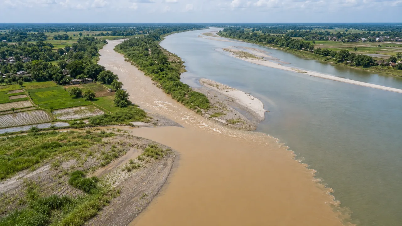
Eastern UP is drained by powerful Himalayan rivers that carry enormous volumes of water, making this region both fertile and flood-prone. These rivers are all left-bank tributaries of the Ganga.
The key idea for this lesson is simple:
eastern UP rivers bring water, silt, and flood risk together. Because they come from the Himalayas and then enter very flat plains, they often overflow, shift channels, and spread water across farmland during the monsoon.
Ghaghra (Saryu) — The Major Eastern Artery
The Ghaghra is generally described as the largest or one of the largest tributaries of the Ganga by water discharge. In the UP context, it is the most important eastern plain river because of its size, flood impact, and religious association through the Saryu name.
| Parameter | Detail |
|---|---|
| Origin | Mapchachungo glacier, Tibet (near Lake Mansarovar) |
| Also called | Karnali (in Nepal), Saryu (in Ayodhya), Gogra |
| Enters UP at | Bahraich district (from Nepal) |
| Total length | ~1,080 km |
| Joins Ganga at | Revelganj, near Chhapra (Bihar border) |
| Major UP centres associated with it | Bahraich, Barabanki, Ayodhya, Gonda-Basti region |
Religious Significance: At Ayodhya, the river is popularly known as the Saryu and holds immense religious importance in the Ramayana tradition. For exams, the strongest association to remember is simply Ayodhya - Saryu.
Ghaghra Tributaries in UP
The Ghaghra system matters because it gathers water from several Himalayan and Terai-fed rivers before moving onward toward Bihar.
| Tributary | Joins Ghaghra at | Key Detail |
|---|---|---|
| Sharda (Mahakali) | Near Bahraich | Forms India-Nepal border in Uttarakhand |
| Rapti | Near Gorakhpur/Deoria | Major flood-causing river |
| Chhoti Saryu | Near Bahraich | Smaller tributary from Terai |
| Kuwano (Kuwana) | Near Basti | Drains central-eastern UP |
Rapti River
| Parameter | Detail |
|---|---|
| Origin | Lower Himalayas in Nepal (Rukumkot range) |
| Enters UP at | Near Bahraich/Siddharthnagar border |
| Flows through | Gorakhpur (city is on Rapti banks) |
| Joins | Ghaghra near Deoria district |
| Length | ~640 km (including Nepal stretch) |
| Key concern | Annual floods in Gorakhpur — causes massive damage to crops and settlements |
The Rapti and its tributary Rohini are the primary cause of flooding in the Gorakhpur region every monsoon season.
This is why Gorakhpur appears repeatedly in UP geography and disaster questions: the Rapti basin combines low gradient, heavy monsoon inflow, and waterlogging-prone terrain.
Gandak River
| Parameter | Detail |
|---|---|
| Origin | Nepal Himalayas (near Tibet border) |
| Also called | Narayani (in Nepal), Salagrami |
| Enters India at | Triveni (Champaran, Bihar) |
| Role in UP | Forms part of the UP-Bihar border (Kushinagar/Deoria area) |
| Joins Ganga at | Near Hajipur (opposite Patna), Bihar |
| Total length | ~630 km |
| Key feature | Gandak Canal (Triveni Canal) irrigates parts of eastern UP and Bihar |
The Gandak is less central to UP than the Ghaghra or Rapti, but it remains important because border rivers and canal-irrigation questions often appear in exams.
Sharda (Mahakali) River
| Parameter | Detail |
|---|---|
| Origin | Milan glacier, Greater Himalayas (Uttarakhand-Nepal border) |
| Also called | Mahakali (in Nepal), Kali |
| International role | Forms India-Nepal border for ~80 km |
| Enters UP plains | Near Pilibhit/Lakhimpur Kheri |
| Joins | Ghaghra near Bahraich |
| Key project | Sharda Canal — major irrigation source for Terai and Rohilkhand regions |
| Treaty | Mahakali Treaty (1996) between India and Nepal for water sharing |
In exam terms, Sharda is important for three reasons together: border geography, irrigation, and Nepal-related river agreements.
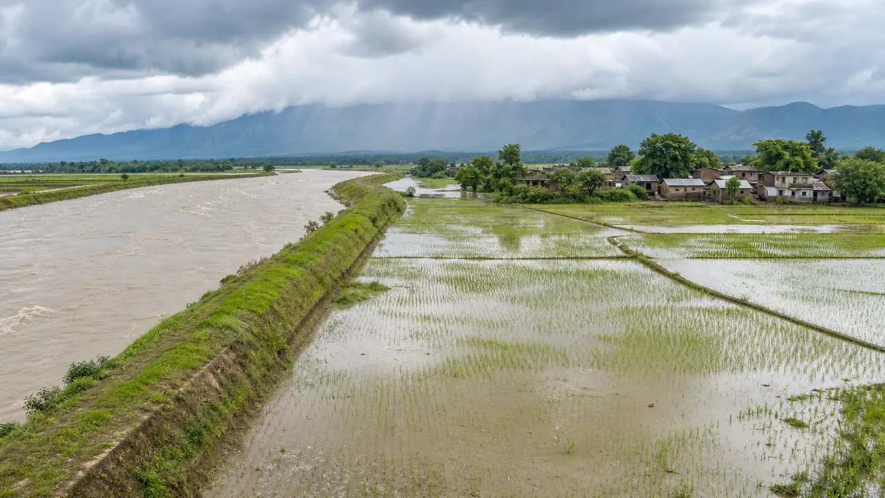
Flood Problem in Eastern UP
Eastern UP faces severe annual flooding due to the Himalayan rivers:
| Factor | Detail |
|---|---|
| Most flood-prone districts | Gorakhpur, Deoria, Kushinagar, Bahraich, Shravasti, Lakhimpur Kheri, Ballia |
| Main flood rivers | Ghaghra, Rapti, Gandak, Sharda |
| Cause | Heavy monsoon rainfall + snowmelt from Himalayas + flat terrain |
| Impact | Crop loss, displacement, waterlogging, spread of diseases |
| Flood management | Embankments, Rapti River channelization, flood forecasting by CWC |
| NDRF presence | Dedicated battalions stationed in Gorakhpur and Varanasi |
The deeper reason for repeated floods is not just heavy rain. These rivers descend from high-relief mountain regions and then suddenly enter a very flat plain. That reduces flow speed, encourages silt deposition, and makes overflow more common.
Exam Tip: Eastern UP rivers are generally perennial because they receive both glacier/snow-fed and monsoon water, unlike many plateau rivers that depend more heavily on rainfall.
Comparison of Eastern UP Rivers
| River | Origin | Enters UP at | Joins | Discharge Rank |
|---|---|---|---|---|
| Ghaghra | Tibet | Bahraich | Ganga (Bihar border) | 1st (highest discharge) |
| Gandak | Nepal | UP-Bihar border | Ganga (Hajipur) | 2nd |
| Rapti | Nepal | Siddharthnagar | Ghaghra (Deoria) | 3rd |
| Sharda | Uttarakhand-Nepal | Pilibhit/Lakhimpur | Ghaghra (Bahraich) | 4th |
Summary Cheat Sheet
| Fact | Answer |
|---|---|
| Major high-discharge eastern tributary | Ghaghra |
| Ghaghra called at Ayodhya | Saryu |
| Ghaghra origin | Mapchachungo glacier, Tibet |
| Rapti flows through | Gorakhpur |
| Gandak also called | Narayani (in Nepal) |
| Sharda forms border with | Nepal |
| Mahakali Treaty year | 1996 |
| Flood-prone eastern UP districts | Gorakhpur, Deoria, Kushinagar, Bahraich, Ballia |
| Ghaghra enters UP at | Bahraich |
| Sharda Canal irrigates | Terai, Rohilkhand |
Lesson Doubts
Ask questions, get expert answers