🏞️ Rivers of Central & Southern UP
Gomti, Sai, Betwa, Ken, Son, and Tons rivers of central and southern Uttar Pradesh — Ken-Betwa River Link Project, Bundelkhand irrigation, and exam facts for Uttar Pradesh GK.
Rivers of Central & Southern UP
Central and southern UP are drained by rivers that originate either in the Terai plains (Gomti) or the Vindhyan Range (Betwa, Ken, Son, Tons). These rivers are crucial for irrigation in the relatively drier Bundelkhand and Vindhyan regions.
The easiest way to understand this lesson is to split it into two river worlds:
- central plain rivers like Gomti and Sai, which are gentler and lower-flow
- southern plateau rivers like Betwa, Ken, Son, and Tons, which are more seasonal, rocky, and closely linked with Bundelkhand and the Vindhyan region
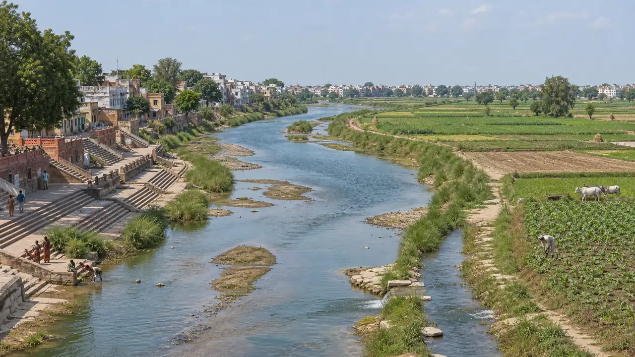
Gomti River — Lucknow's Identity River
The Gomti is one of the most important rivers that originates within Uttar Pradesh and flows largely within the state. That is why it has a special place in UP geography, especially for Lucknow and eastern plain drainage.
| Parameter | Detail |
|---|---|
| Origin | Gomat Taal (Fulhar Jheel), Pilibhit district |
| Total length | ~900 km |
| Flows through | Pilibhit, Shahjahanpur, Lakhimpur, Lucknow, Sultanpur, Jaunpur, Ghazipur |
| Joins Ganga at | Kaithi, near Ghazipur (Saidpur) |
| Type | Rain-fed and spring-fed (not glacial — hence low flow in summer) |
| Key feature | Defines Lucknow's cultural landscape — riverfront, Residency, Imambaras |
Gomti Riverfront Project: The Lucknow government developed a riverfront along the Gomti modeled on the Sabarmati Riverfront in Ahmedabad, though it has faced environmental criticism.
For students, the most important contrast is this: unlike the Ghaghra or Rapti, the Gomti is not a high-discharge Himalayan flood river. It is a gentler plain river, so questions about it are more often linked with Lucknow, origin, tributaries, and urban pollution than with major flood geography.
Gomti Tributaries
| Tributary | Joins At | Key Detail |
|---|---|---|
| Sai | Near Jaunpur/Pratapgarh | Largest tributary of Gomti |
| Kathna | Near Sitapur | Drains Terai region |
| Sarayan | Near Sultanpur | Minor tributary |
| Nand | Near Sultanpur | Seasonal stream |
Sai River
| Parameter | Detail |
|---|---|
| Origin | Near Hardoi district |
| Length | ~600 km |
| Flows through | Hardoi, Rae Bareli, Pratapgarh, Jaunpur |
| Joins | Gomti near Jaunpur |
| Significance | Major irrigation source for Rae Bareli and Pratapgarh districts |
| Key concern | Drying up in summers, pollution from towns |
The Sai is important mainly because it strengthens the Gomti system within the plains of central and eastern UP. It is usually examined as a supporting tributary fact rather than as a stand-alone major river.
Betwa River
| Parameter | Detail |
|---|---|
| Origin | Near Hoshangabad (Narmadapuram), Vindhyan Range, MP |
| Also called | Vetravati (ancient name) |
| Total length | ~590 km |
| Enters UP at | Near Jhansi |
| Flows through | Jhansi, Hamirpur |
| Joins Yamuna at | Near Hamirpur |
| Key dams | Matatila Dam (Jhansi), Rajghat Dam (UP-MP joint), Parichha Dam |
| Significance | Ken-Betwa River Link Project — major Bundelkhand water-transfer project |
Ken River
| Parameter | Detail |
|---|---|
| Origin | Near Ahirgawan, Jabalpur, MP (Vindhyan Range) |
| Total length | ~427 km |
| Enters UP at | Near Banda district |
| Flows through | Banda, Chitrakoot |
| Joins Yamuna at | Near Chilla (Banda district) |
| Key feature | Flows through Panna Tiger Reserve (MP) — rich in diamonds |
| Significance | Source river for Ken-Betwa Link Project |
Betwa and Ken are best studied together because both are Bundelkhand-linked plateau rivers that eventually join the Yamuna. In exam terms, students should connect them with Jhansi, Banda, Hamirpur, drought, dams, and inter-basin water transfer.
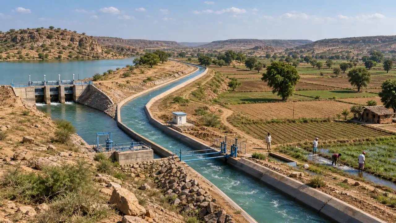
Ken-Betwa River Link Project
This is generally presented as India's first major river-linking project to move into implementation in this form, aimed at reducing Bundelkhand's chronic water stress.
| Parameter | Detail |
|---|---|
| Approved | 2021 (Union Cabinet approval) |
| Cost | ~₹44,605 crore (revised estimates) |
| Concept | Transfer surplus water from Ken (surplus basin) to Betwa (deficit basin) |
| Dam | Daudhan Dam on Ken river in MP |
| Canal | 221 km link canal |
| Beneficiary states | UP (Bundelkhand) and MP |
| Irrigation benefit | ~10.62 lakh hectares (6.35 lakh ha in MP, 4.27 lakh ha in UP) |
| Districts benefited (UP) | Banda, Mahoba, Jhansi, Lalitpur, Chitrakoot |
| Hydropower | 103 MW generation planned |
| Concern | Submergence of part of Panna Tiger Reserve |
This project matters because it combines geography, irrigation, environment, and inter-state cooperation in one topic. For UP exams, the highest-yield memory pair is Ken -> source basin and Betwa -> receiving basin.
Son River
| Parameter | Detail |
|---|---|
| Origin | Amarkantak, MP (same origin area as Narmada) |
| Total length | ~784 km |
| In UP | Flows along the southern edge (Sonbhadra, Mirzapur) |
| Joins Ganga at | Near Patna (in Bihar) |
| Key feature | Rihand River (tributary of Son) — Rihand Dam in Sonbhadra |
| Significance | Marks the boundary between Vindhyan and Gangetic plains |
The Son is more important for the south-eastern edge of UP, especially Sonbhadra, than for the central plain. Students usually meet it in questions connected with Rihand, Sonbhadra, dams, and the Vindhyan margin.
Tons River
| Parameter | Detail |
|---|---|
| Origin | Tamsa Kund, Satna district, MP |
| Length | ~264 km |
| Flows through | Southern Prayagraj district |
| Joins Ganga at | Near Sirsa (Prayagraj) |
| Note | Not to be confused with Tons River of Uttarakhand (tributary of Yamuna) |
This distinction is important because many exams use the name "Tons" to confuse students. In UP GK, this lesson refers to the Tamsa/Tons joining the Ganga near Prayagraj, not the better-known Tons of the Yamuna basin in Uttarakhand.
Drainage Pattern Comparison
| Region | Rivers | Origin Type | Character |
|---|---|---|---|
| Central UP | Gomti, Sai | Plains/Terai | Rain-fed, low summer flow |
| Southern UP (Bundelkhand) | Betwa, Ken | Vindhyan / plateau region | Seasonal, rocky terrain |
| Southern UP (Vindhyan) | Son, Tons | Vindhyan/Amarkantak | Rocky, waterfall-prone |
Summary Cheat Sheet
| Fact | Answer |
|---|---|
| Gomti origin | Gomat Taal, Pilibhit |
| Gomti joins Ganga at | Ghazipur |
| Gomti flows through | Lucknow |
| Sai joins | Gomti near Jaunpur |
| Betwa joins Yamuna at | Hamirpur |
| Ken joins Yamuna at | Chilla, Banda |
| Ken-Betwa Link approved | 2021 |
| Ken-Betwa project logic | Ken to Betwa water transfer for Bundelkhand |
| Ken-Betwa beneficiary | Bundelkhand (UP & MP) |
| Son origin | Amarkantak, MP |
| Tons joins Ganga at | Sirsa, Prayagraj |
Lesson Doubts
Ask questions, get expert answers