🏜️ Wasteland Development
Wasteland classification, extent in India, shifting cultivation local names, and causes of wasteland formation
What is Wasteland?
In the previous lesson, we studied ICRAF's Diagnosis and Design (D&D) methodology for planning agroforestry interventions. One of the most important targets for such interventions is wasteland -- degraded or underutilised land that represents both a challenge and an opportunity.
Wasteland is land that is presently lying unused or is not being used to its optimum potential due to physical, chemical, or socio-economic constraints. India has vast stretches of such land, and reclaiming them through agroforestry, social forestry, and watershed management is a national priority.
This lesson covers:
- Classification -- Cultivable vs uncultivable wastelands (National Wastelands Development Board)
- Extent in India -- Total area, state-wise changes, and conversion patterns
- Causes -- Why wastelands form and persist
- Shifting cultivation -- Local names across India and the world
Wasteland development is frequently tested in exams, NABARD, and FCI exams, especially the classification, state-level data, and shifting cultivation names.
Classification of Wastelands
The fundamental distinction in wasteland management is whether the land can be reclaimed for productive use or not. The National Wastelands Development Board (NWDB) classifies wastelands into two categories based on this reclamation potential.
Pro Content Locked
Upgrade to Pro to access this lesson and all other premium content.
₹99 charged monthly · Cancel anytime
- All Agriculture & Banking Courses
- AI Lesson Questions (100/day)
- AI Doubt Solver (50/day)
- Glows & Grows Feedback (30/day)
- AI Section Quiz (20/day)
- 22-Language Translation (100/day)
- Recall Questions (20/day)
- AI Quiz (15/day)
- AI Quiz Paper Analysis (100/day)
- AI Step-by-Step Explanations (100/day)
- Spaced Repetition Recall (FSRS)
- AI Tutor
- Immersive Text Questions
- Audio Lessons — Hindi & English
- Mock Tests & Previous Year Papers
- Summary & Mind Maps
- XP, Levels, Leaderboard & Badges
- Generate New Classrooms
- Voice AI Teacher (AgriDots Live)
- AI Revision Assistant
- Knowledge Gap Analysis
- Interactive Revision (LangGraph)
🔒 Secure via Razorpay · Cancel anytime · No hidden fees
What is Wasteland?
In the previous lesson, we studied ICRAF's Diagnosis and Design (D&D) methodology for planning agroforestry interventions. One of the most important targets for such interventions is wasteland -- degraded or underutilised land that represents both a challenge and an opportunity.
Wasteland is land that is presently lying unused or is not being used to its optimum potential due to physical, chemical, or socio-economic constraints. India has vast stretches of such land, and reclaiming them through agroforestry, social forestry, and watershed management is a national priority.
This lesson covers:
- Classification -- Cultivable vs uncultivable wastelands (National Wastelands Development Board)
- Extent in India -- Total area, state-wise changes, and conversion patterns
- Causes -- Why wastelands form and persist
- Shifting cultivation -- Local names across India and the world
Wasteland development is frequently tested in exams, NABARD, and FCI exams, especially the classification, state-level data, and shifting cultivation names.
Classification of Wastelands
The fundamental distinction in wasteland management is whether the land can be reclaimed for productive use or not. The National Wastelands Development Board (NWDB) classifies wastelands into two categories based on this reclamation potential.
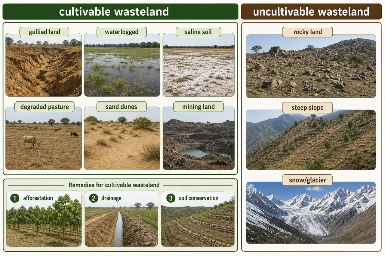
1. Cultivable Wastelands
These are lands that can potentially be brought under productive use through appropriate interventions like agroforestry, soil conservation, or drainage improvement:
- Gullied and/or ravinous lands -- formed by water erosion cutting deep channels, common in Uttar Pradesh, Madhya Pradesh, and Rajasthan
- Undulating land without shrubs -- uneven terrain stripped of vegetation cover
- Surface waterlogging land and marsh -- areas where excess water accumulates due to poor drainage or high water table
- Salt-affected land -- soils with high salinity or alkalinity that inhibit plant growth; reclaimed using gypsum application and drainage
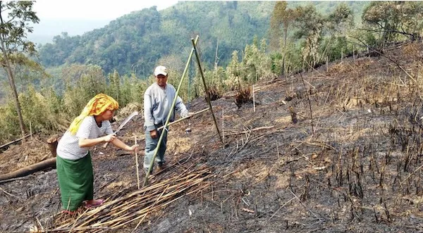
- Shifting cultivation area -- land degraded by repeated slash-and-burn cycles (called jhum in Northeast India)
- Degraded forestland -- forests that have lost canopy cover and biodiversity due to overexploitation
- Degraded pasture / grazing land -- overgrazed areas where palatable species have been replaced by unpalatable weeds
- Degraded forest plantations -- failed or poorly maintained tree plantations
- Strip lands -- narrow degraded strips along roads, railways, and canals
- Sand dunes -- wind-deposited sand formations, predominantly in Rajasthan's Thar Desert
- Mining / industrial wastelands -- land degraded by mining operations, dumping of mine waste, and industrial effluents
2. Uncultivable Wastelands
These lands cannot be used for vegetation due to permanent physical limitations:
- Barren rocky / stony areas -- exposed rock surfaces with no soil for plant establishment
- Steep sloping areas -- terrain too steep for any cultivation or plantation without prohibitive cost
- Snow-covered and/or glacial lands -- permanently frozen areas at high altitudes
IMPORTANT
The exam distinction is simple: cultivable wastelands (11 types) can be reclaimed through agroforestry, watershed management, and soil conservation. Uncultivable wastelands (3 types) cannot support vegetation due to physical constraints like rock, steep slopes, or permanent snow.
Extent of Wastelands in India
India's wasteland data comes from the Wastelands Atlas of India published by the Department of Land Resources. The numbers reveal both the scale of the challenge and the progress being made.
- Total wastelands in India (2015--16): 55.76 Mha (16.96% of geographical area) -- nearly one-sixth of India's total land is classified as wasteland
- In 2008--09, India's total wasteland was 56.60 Mha (17.21%)
- Change in 2015--16 compared to 2008--09: 8,404 sq. km decrease (0.26%) -- a modest but measurable improvement driven by afforestation and land reclamation programmes
- Per capita agriculture land in India: 0.12 ha -- less than half the world average, highlighting the urgency of wasteland reclamation
- World per capita agriculture land: 0.29 ha
Conversion of Wastelands
The majority of reclaimed wastelands have been converted into croplands, showing that agroforestry and land development programmes are directly expanding India's productive agricultural base:
| Converted To | Area (Mha) |
|---|---|
| Croplands | 0.64 |
| Forest -- Dense/Open | 0.28 |
| Forest Plantation | 0.029 |
| Plantation | 0.057 |
| Industrial Area | 0.035 |
State-wise Changes
- Decrease in wastelands observed in 18 states, increase in 11 states
- States with the largest decrease: Rajasthan (0.48 Mha) -- extensive desert stabilisation and canal irrigation, Bihar (0.11 Mha), Uttar Pradesh (0.10 Mha), Andhra Pradesh (0.08 Mha), Mizoram (0.057 Mha), Madhya Pradesh (0.039 Mha), Jammu & Kashmir (0.038 Mha), West Bengal (0.032 Mha)
- States with increase in wastelands: Odisha (465.82 sq. km) -- mining and industrial degradation, Assam (406.69 sq. km), Telangana (377.79 sq. km), Chhattisgarh (373.54 sq. km)
IMPORTANT
Highest wasteland -- Jammu & Kashmir (1,75,697.01 sq. km) -- largely due to snow-covered and glacial areas in Ladakh. Lowest wasteland -- Delhi (81.27 sq. km) -- smallest geographical area among states/UTs.
WARNING
Do not confuse highest wasteland area (Jammu & Kashmir) with highest wasteland percentage. Jammu & Kashmir tops in absolute area because of its vast glacial and rocky terrain, not because of agricultural degradation.
Causes of Wasteland Formation
Wastelands do not form overnight -- they result from prolonged misuse or neglect of land resources. Understanding the causes helps in designing appropriate reclamation strategies.
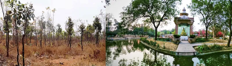
- Deforestation -- removal of tree cover exposes soil to wind and water erosion, leading to gullied and ravinous lands. This is the single largest cause of wasteland formation in India.
- Over-cultivation -- continuous cropping without fallowing or organic inputs depletes soil nutrients and degrades soil structure, eventually making the land unproductive
- Overgrazing -- excessive livestock pressure destroys palatable grasses and compacts soil, replacing productive pastures with thorny and unpalatable weeds
- Unskilled irrigation -- improper canal management and flood irrigation without drainage causes waterlogging (raising water table) and salinisation (salt accumulation on the surface)
- Improper developmental activities -- dumping of industrial waste, mine spoils, and urban refuse physically degrades land and introduces toxic chemicals into the soil
Category-wise Wastelands of India
The Wastelands Atlas breaks down India's total wasteland into detailed categories. The largest categories are barren rocky/stony areas, snow-covered/glacial areas, and land with scrub -- together accounting for over 70% of all wastelands.
| Category | Area (sq. km) | % of Total |
|---|---|---|
| Gullied/Ravinous land (Medium) | 6,484 | 0.20 |
| Gullied/Ravinous land (Deep) | 3,109 | 0.09 |
| Land with Dense Scrub | 73,972 | 2.25 |
| Land with Open Scrub | 99,602 | 3.03 |
| Waterlogged & Marshy (Permanent) | 1,627 | 0.05 |
| Waterlogged & Marshy (Seasonal) | 5,199 | 0.16 |
| Salt affected (Medium) | 4,723 | 0.14 |
| Salt affected (Strong) | 1,586 | 0.05 |
| Shifting Cultivation — Current Jhum | 3,871 | 0.12 |
| Shifting Cultivation — Abandoned Jhum | 4,575 | 0.14 |
| Under-utilised/Degraded forest (Scrub) | 86,411 | 2.63 |
| Under-utilised/Degraded forest (Agriculture) | 21,691 | 0.66 |
| Degraded pastures/grazing land | 6,450 | 0.20 |
| Sands — Desertic | 8,192 | 0.25 |
| Sands — SemiStab (> 40m) | 9,345 | 0.28 |
| Sands — SemiStab (15-40m) | 11,801 | 0.36 |
| Mining Wastelands | 2,256 | 0.07 |
| Barren Rocky/Stony | 94,484 | 2.87 |
| Snow covered/Glacial area | 1,07,928 | 3.28 |
| Total | 5,57,666 | 16.96 |
Shifting Cultivation -- Local Names
Shifting cultivation (also called slash-and-burn or swidden agriculture) involves clearing a patch of forest, burning the vegetation, cultivating crops for 1--3 years until soil fertility declines, then abandoning the plot and moving to a new area. It is one of the major causes of wasteland formation, particularly in the hilly regions of Northeast India. The practice is known by different names across the world and in different regions of India -- exam questions frequently test these local names.
World
| Name | Region |
|---|---|
| Milpa | Yucatan and Guatemala |
| Milya | Mexico and Central America |
| Konuko | Venezuela |
| Roka | Brazil |
| Taungya | Myanmar |
| Chena | Sri Lanka |
| Ladang | Java and Indonesia |
India
| Name | Region |
|---|---|
| Jhum | North-eastern India |
| Vevar and Dahiyaar | Bundelkhand Region (Madhya Pradesh) |
| Deepa | Bastar District (Madhya Pradesh) |
| Zara and Erka | Southern States |
| Batra | South-eastern Rajasthan |
| Podu | Andhra Pradesh |
| Kumari | Hilly Region of Western Ghats of Kerala |
| Kaman, Vinga and Dhavi | Odisha |
TIP
For exams, remember the Indian names: Jhum (NE), Podu (AP), Kumari (Kerala), Deepa (Bastar), Batra (Rajasthan). Think JPKDB — "Jhum Podu Kumari Deepa Batra".
Summary Cheat Sheet
| Concept / Topic | Key Details |
|---|---|
| Wasteland | Land lying unused or not used to optimum potential due to constraints |
| Classification | Two categories: Cultivable (11 types) and Uncultivable (3 types) |
| Classifying body | National Wastelands Development Board (NWDB) |
| India's wasteland area (2015--16) | 55.76 Mha (16.96% of geographical area) |
| Per capita agri land (India) | 0.12 ha (world average: 0.29 ha) |
| Highest wasteland | Jammu & Kashmir (1,75,697 sq. km) |
| Lowest wasteland | Delhi (81.27 sq. km) |
| Largest decrease (state) | Rajasthan (0.48 Mha) |
| Causes of wasteland | Deforestation, over-cultivation, overgrazing, unskilled irrigation, improper development |
| Shifting cultivation names | Jhum (Northeast), Podu (Andhra Pradesh), Kumari (Kerala), Deepa (Bastar), Batra (Rajasthan) |
| Mnemonic for names | JPKDB -- "Jhum Podu Kumari Deepa Batra" |
| Other Indian names | Vevar/Dahiyaar (Bundelkhand), Zara/Erka (Southern states), Kaman/Vinga/Dhavi (Odisha) |
| Key reclamation methods | Afforestation, contour bunding, check dams, gully plugging, watershed management |
| Key species for wastelands | Prosopis juliflora, Acacia, Casuarina, Eucalyptus |
TIP
Next: Lesson 08 covers Forest Products -- timber, industrial wood, and the 11 categories of Non-Timber Forest Products (NTFPs) that sustain 275 million forest-dependent people in India.